Showing posts sorted by relevance for query wellington. Sort by date Show all posts

Tuesday, January 5, 2016

Yerington Monday: A Little Wellington History

Yerington Monday:  A Little Wellington History

About five miles from the town of Smith is the little town of Wellington.  They are both in Smith Valley.  I remember Wellington best for its indoor swimming pool. As kids of the fifties, we would beg our parents to drive us the 26 miles so we could swim.  It was the only action back then.  I also remember lots of cattle and sheep interrupting our drive as they crossed the road.  I alway found Wellington to be a picturesque little town in this agricultural valley.  It, like Smith, has a very interesting history. (click on the pictures to discover more).


Wellington Post Office/ Wells Fargo Ticket Office
Date: 1865-1911
Location: The original site was near the Iron Bridge on the east side of the river in Wellington. It is presently located in a field on Day Lane on the property of Mr. Ben Harrison.

History: The 12 by 16 foot building served as a post office and a Wells Fargo ticket office. The Wells Fargo Official Directory first shows an agency in Wellington in 1872. There was an agent at this site from 1872 to 1890.


Wellington Brick Building
Date: 1873
Location: Highway 208 adjacent to the CG Bar

History: Sidney Sweetman worked for Cyrus Smith before 1889 and was a stonemason and farmer by trade. Sweetman formed and fired the bricks and built this building as his home. Mrs. Mary Hoye later used it as a private school for her niece and nephew, with Miss White as their teacher. In the 1920's the building became a butcher shop run by Joe Azneraz. The building is now restored and is used as a wine cellar and office.


Heyday Inn
Date: Circa 1875
Location: 3 Wellington Cutoff, Wellington

History: The Heyday Inn is a two-story wood structure that is currently operated as a restaurant and bar. The ground floor contains a dining room, bar, restrooms, private meeting room, and the kitchen facilities. The top story is an apartment where the current owners reside. The private meeting room is the weekly location for the Smith Valley Rotary Club and Soroptimist International of Smith Valley. The Heyday Inn was built around 1875 by Zadok Pierce. It was called Pierce Station, which was a grocery store, hotel and feed store. Travelers came by stagecoach from the V&T train station in Minden, crossing the West Walker River and down Hoye Canyon to Pierce Station where the stage line ended. Passengers on their way to Sweetwater, Bridgeport, Bodie and Aurora would spend the night. The next day a spring wagon would take the passengers and mail on the rest of the journey. In 1903 W. E. Reading and Gould Reading from Bodie bought Pierce Station. They changed the name to W. E. Reading General Merchandise. They served the Valley ranchers and mining towns in the area. Around 1945 Perry and Gerri Aikins bought the store and called it the Heyday Inn. They opened it as a bar and restaurant until the early sixties when they sold it. In 1980 Bill and Sherri Carlson and J.P. and Marilyn Ithurburu purchased it from Ernest Groso. They did all the remodeling themselves and opened in January of 1983, roughly 100 years since it was built. The outside of the building is original but the inside has been completely remodeled. On July 1, 2001, Bill and Ellie Bohlin took over operation of the Heyday and continue to operate it as a restaurant and bar.


Hoye Mansion
Date: 1878
Location: The Hoye Mansion is in Wellington, on Highway 208.

History: John and Mary Hoye came from Ireland and settled on the Walker River, south of Wellington, where they had a river crossing and station. In 1878 they moved their buildings north up the river canyon to Wellington and opened the Wellington Mercantile. They built the Hoye Mansion, which took five years to complete, a barn, a blacksmith shop, gardens and an orchard. The building materials for the house included square nails, white pine beams, framing 2x4s, 2x12s and 2x11s, provided by the Truckee Lumber Company. The house has four fireplaces, twenty double-hung windows, a lofty stairway, 11’6” ceilings, and screened in porches on both the first and second floor. The attic was filled with beds for travelers to rent. The mansion was a cheery, cozy, and elegant hotel home. In the 1880s, Mrs.Hoye had quite a reputation for setting a fine table. In 1915 at age 80, Mary Hoye passed on, leaving an elegant home and legacy.
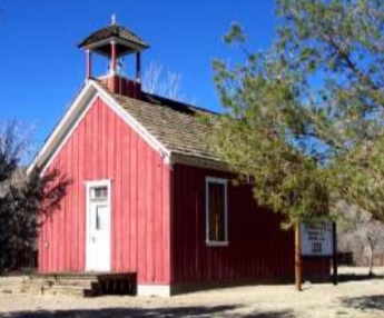

Old Wellington Schoolhouse
Date: 1898
Location: Presently located at 2855 Highway 208, at the Wellington Station Resort, Wellington

Description: The Wellington School House was built in 1898 in the heart of Wellington. In 1971, James and Marion Compston obtained the schoolhouse from Mr. Verl Fell and Joe Acciari Moving moved it from its original site to its present site at the Wellington Station Resort. The Compton's restored the school building with a new roof, paint, and power for electric lighting. The Cupola on the top of the building was from the old Smith Valley  Grammar School on Smith Gage Road, donated by Pauline and Basil Quilici. Jim and  Marion purchased the bell from Mr. Gus Neese of Carson City. Jim Compston had the idea of making the building a museum, using artifacts from the Smith Valley area and from Nevada, in general. He used old boards and hinges from his ranch, and gradually put the museum together. The Schoolhouse/Museum is open to all upon appointment.
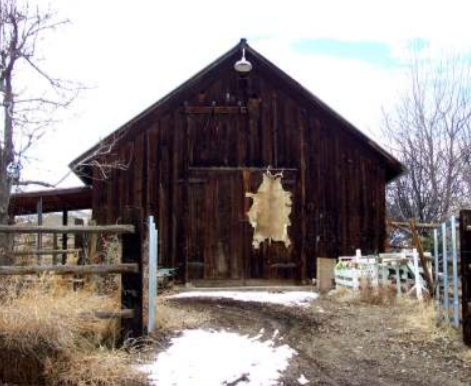


The Hoye Blacksmith Shop
Date: 1878
Location: The blacksmith shop is located in Wellington, Nevada on the property of Dr. Robin Titus.

History: John and Mary Hoye moved to Wellington from their toll bridge crossing on the Walker River south of the canyon in 1878. One of the buildings they erected was a blacksmith shop. In 1991, Frank Parsons and John Hara put a new foundation under the shop and added a half second floor. This half floor has served as an art studio, a doll studio, an exercise room, and a bedroom. Currently, the blacksmith shop is used as a barn and carriage house. The forge is still in the building.
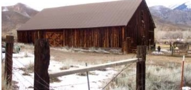

Hoye, Groso Barn
Date: Circa 1879
Location: The Hoye /Groso Barn is located on Hoye Canyon Road just west of Highway 9 208 in Wellington.

History: John and Mary Hoye moved to Wellington from their previous location at the  south end of what is known today as Hoye Canyon. They needed a very large barn to  service the many mule and horse teams that carried supplies to the mines. The barn  was built about the same time as the Hoye Mansion and blacksmith shop. Maxine Groso now owns the barn and still uses it in caring for her sheep.


Hobart/Rogers/Fulstone Barn
Date: Circa late 1880’s
Location: Off of Highway 208 in Wellington

History: Since 1863 official records show that three families (Hobart, Rogers, Fulstone) have owned the land where this barn is constructed. It is not clear, who actually built the barn. Richard Fulstone, grandson of Annie and George Fulstone, purchased the ranch in the late 1980’s. He put a new roof on the barn and repaired some of the inside posts to keep the barn from deteriorating any further.
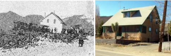

Sayre House
Date: Circa 1900
Location: Highway 208 Wellington, Nevada

History: The Sayre house was built by the Shreck brothers on the west corner of Rivers Road and Smith Gage Road. Sophia Shreck married Andrew Phleming in 1889 and raised their family in this house while it was at the Rivers Road location. When the children were grown, Sophia Shreck Sayre and her unmarried daughter converted it into a boarding house. In about 1919, the house was moved to Wellington with the aid of three large caterpillar tractors, skids, and large rolling logs. The present owner is Steve Bohler of Carson Valley.
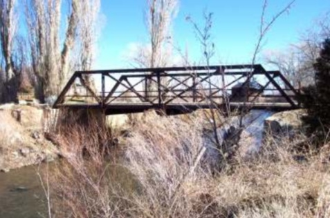

"Old Iron Bridge"
Date: Circa 1918
Location: The bridge is located in Wellington, just off of Smith Gage Road and Hwy. 208. It traverses the West Walker River on the James Compston Jr. Ranch.

History: The iron bridge, a Delaware/Lacawana train bridge, was erected about 1918, to replace a wooden bridge that crossed the West Walker River. All travelers coming into Smith Valley by way of Jack Wright Pass used the Iron Bridge. The original road came through what is presently the James Compston Jr. Ranch and then crossed the West Walker River. The Nevada State Highway Dept. built a new highway and a new cement bridge (Hwy 17 208). Today the Old Iron Bridge is an entrance to the Compston Ranch.
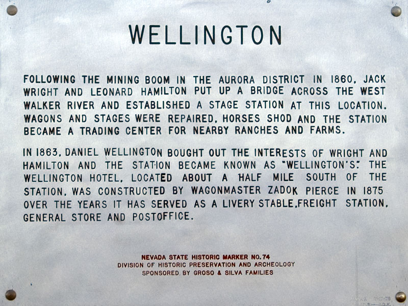

Wellington
Following the mining boom in the Aurora District in 1860, Jack Wright and Leonard Hamilton put up a bridge across the West Walker River and established a stage station at this location. Wagons and stages were repaired, horses shod and the station became a trading center for nearby ranches and farms.
In 1863, Daniel Wellington bought out the interests of Wright and Hamilton and the station became known as "Wellington's." The Wellington Hotel, located about a half mile south of the station, was constructed by wagonmaster Zadok Pierce in 1875. Over the years it has served as a livery stable, freight station, general store and post office.

Yerington Monday:  A Little Smith Valley History


A pleasant 21-mile drive from Yerington through Mason Valley and Wilson Canyon will drop you into beautiful Smith Valley, an agricultural community with an interesting history.  Yerington and Smith Valley have been like sister towns - like one big family. When  was a kid everyone knew everyone in both valleys. (click on a picture to learn more about its history.)


The lush meadow grass of Smith Valley lured Cyrus Smith and followers to settle on the west side of the Walker River and the location became known as Smith's Station. Cyrus Smith built a home in 1860 and a large barn in 1872. For many years, the ranch was owned by Andy Sayre Jr., who sold it to the present owner, David Traitel. The Smith barn has been in continuous use for over 130 years.


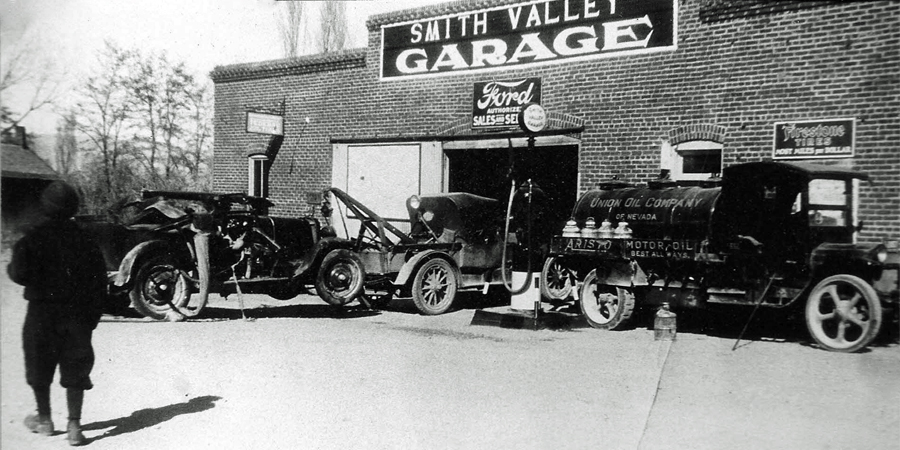
Smith Valley Garage has been serving the agricultural equipment needs of Northern Nevada and the Eastern Sierra for over 90 years.  Bert Werner joined with Johnny Neumaker and a banker in 1919 to build Smith Valley Garage.  With determination and hard work, they even survived the depression and bank failures of the 1930’s.  During World War II, the business consisted primarily of service, maintenance, and making improvements to all kinds of farm, road, and mining equipment.  This enabled ranchers and others to produce more for the war effort.  In the 1950’s, Bert Werner sold the business to his son, Bill.  In 1959, it was purchased by Bob and Martha Griffin. The next owner was Ben Barton, and later it was owned by Ernie Groso.  The current owners, Dan and Shawna Smith, purchased the business in 1983.
What started out as a co-op and blacksmith shop in 1919 gradually evolved over the decades into the computerized environment in which we operate today.  Although steam pumps and daisy reapers have been replaced with computers and GPS systems, our service to our customers has never wavered.  We remain dedicated to the agricultural community as never before.

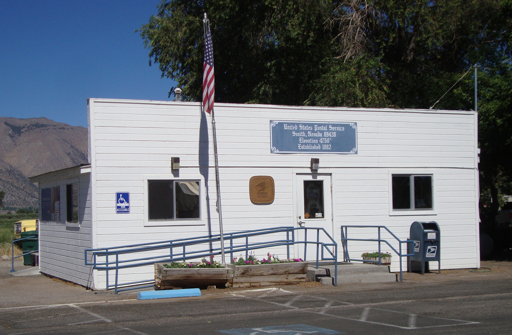
Date: 1892 SV Post Office
Location: 2306 Highway 208
History: The Smith Post Office was established on June 4, 1892 and located in the home of Laureston Robert Ames on Smith Gage Road. Ames was the first postmaster  and served until March 4, 1902. This house is now located on the corner of Highway 208 and Harrison Drive. A new building for the post office was built between the Central Mercantile and a service station (which now houses Renner’s Equipment). The  building was later moved to its present location in Smith sometime after 1946. Two  additions were made to the post office that added more post boxes and a restroom. In the 112-year history of the Smith Post Office, only 10 people have held the position of postmaster.


Date: 1926
Location: Central Mercantile and Central Bar are in Smith, locally known as Central, on Highway 208


History: In 1926, Harold Elder and Harry Wylie built the Central Mercantile and August Menke later added a butcher shop to the business. In 1932, after prohibition, Harry Wylie added a small bar. Guy Fabri purchased the property and operated the business  until January 1, 1946, when John and Joe Giomi bought it. The Giomi brothers wanted  to make a larger store so they moved the old Wellington Bar, which was then south of  the Heyday Inn, to where it is presently located.


Fred and Dr. Mary Fulstone's Home  
Date: 1879
Location: Approximately 1/2 mile south of Smith on Highway 208


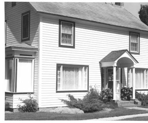
History: The Simpson family built the two-story front portion of the house in 1879. The back section, which became a kitchen, dining room, and future waiting room and medical office, was added later. In 1916, Joe and Fred Fulstone bought this 600 acre ranch from the Simpsons. Joe died in the flu epidemic of 1918. Fred married Dr. Ruth Hill in 1919. Dr. Mary, as she was known, was a graduate of the UCSF School of Medicine and held office hours in this house until she retired at the age of 84. Dr. Mary passed away in 1987 at the age of 95.


Smith Valley Community United Methodist Church
Date: 1895
Location: 44 Rivers Road, Smith


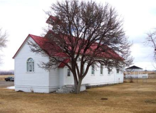
History: The Methodist Church, which began as a circuit rider ministry, was built on the vacated site of the old school house, on land purchased from Samuel and Isabella Weymore. They were paid a five-dollar gold piece for "one acre more or less" as described on the deed. Construction began in 1894 with a native stone foundation built by Sidney Sweetman, a local mason, and was completed in July, l895. The remodeled sanctuary, with its exceptional stain glass windows, is still sitting on that foundation. The church bell was added in 1930 and it continues to ring to open worship services today. Mr. C. Turner originally bought the bell for the 1890 Wellington School, but when the school moved, the bell was moved to the church according to the directions in 18 Mr. Turner’s will. The church celebrated its centennial anniversary in 1995.


The Smith Valley SV
Date: 1919-1920 to present
Location: The Smith Valley SV is located on the Wellington Hills.

History: The county surveyor marked the SV site on the hill across the road from Smith Valley High School. Students from the high school laid the rocks for the SV, but on completion, decided that it was too small. In 1924, they constructed and white washed the SV that is present today. The letters are approximately 50'x30' and are visible from most Valley locations. At one time burros packed water up from the Plymouth ditch so that students could whitewash the rocks. Today, Block SV students (Varsity Letter winners) and staff continue this tradition, however, they now use quad ATV to haul supplies up the hill to paint the SV letters.

Yerington Monday: The Mines of Lyon County: Pine Grove

Yerington Monday:  The Mines of Lyon County:  Pine Grove

(Posted on Facebook December, 28, 2015)

Everyone knows about the Anaconda Mine at Weed Heights, but if you are like me, you may not know much about the many mines in our county.  I thought it would be interesting to explore them and discover some of our mining roots.  Yerington and Smith Valley are well known for two things mining and farming.  These two industries have been crucial in developing our towns in Lyon county.

Pine Grove is one of the lesser-known gold mining camps but lasted longer than most. Gold was first discovered here in 1866 and within a year or so the town had grown to 300 people. Its zenith was in the 1880's when three mills were shipping $10,000 in gold bullion each week and the town had grown to over 1000 people. Pine Grove is located about 26 miles south of Yerington in the mountains just south of Wellington, NV


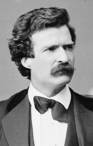
At one time, all of the Crazy Horse Mining Area was owned by Samuel Clemens (Mark Twain) who did not realize its value. Lyon County records note the sale of this property to him.  It was to become a large copper installation mined by Anaconda Copper Company.

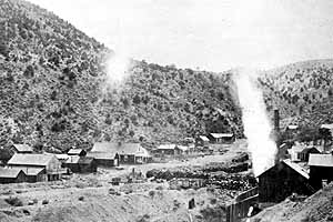
Pine Grove, about 1870

Gold was discovered here in 1866 by William Wilson.  By summer, the area was saturated with prospectors.  The town site was originally named Wilsonville, but was changed to Pine Grove in 1868.  By this time the townsite had a post office, the weekly News, and a population of around 200.  Two steam-powered stamp mills and three arrastras treated both gold and silver ores.  Supplies were brought in by freight lines from as far away as Sacramento California.


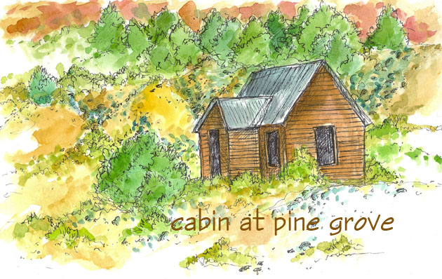
Pine Grove Nevada Painting

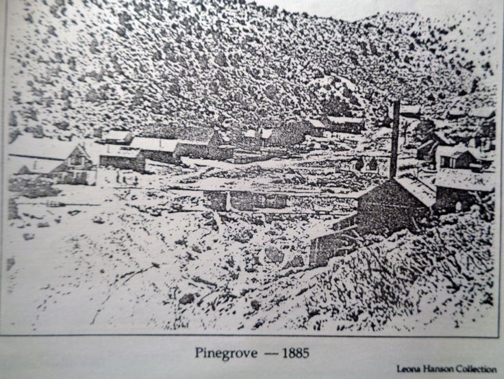
Pine Grove - 1885

School at Pine Grove


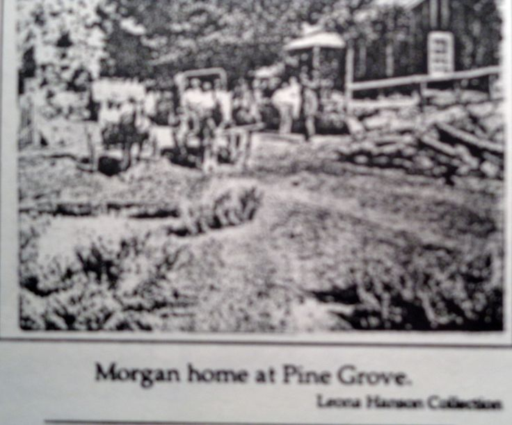
Many of the people who worked in the Pine Grove Mine settled with their families in Yerington or on ranches in the valley after the mining boom was over.  Foremost among them were the Wilson family, the Morgan family, the Strosnider family and others, including descendants of William Dexheimer, the grandfather of Phyllis Matheus.

Cathie Richardson  Lives in Fallon Nevada

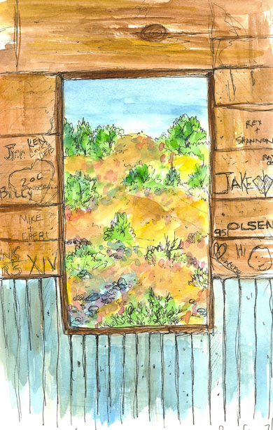
“I walked up to the cabin and sat on one of the windowsills, the cabin has really large windows.  I really liked the view from the inside out.  Lots of people visit up there and leave their mark on the inside walls of the cabin so I added them to my drawing.  Lots of love notes, hearts, names and a note to be careful next to a smiley face.  I will be. “  ~~~ Cathie Richardson  Lives in Fallon Nevada

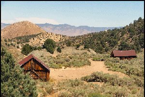
Pine Grove remains

History of Pine Grove, NV

An Indian showed William Wilson the gold bearing rocks in June of 1866 and prospectors stampeded the area through the summer.  At first called Wilsonville, the camp was renamed Pine Grove, with a post office, the weekly news, and a population of 200. Two steam powered stamp mills and three arrastras treated both both and silver ores, while stages and freight lines brought in supplies and hauled out bullion.

In the early 1870's, the population reached it's peak of 600.  The tri-sectioned camp straggled for a mile of the canyon and contained five saloons, three hotels, a variety store, a hardware store, a Wells Fargo agent, a dance hall, blacksmith shops, general merchandise, barbershops, a shoeshine shop, a school, oxen yards, livery stables, and two doctor's offices.

There were two large mines, the Wilson Mine and the Wheeler Mine.  By 1893, these two mills produced $8 million in bullion.  
Additionally, a stage and freight line was established, which connected the mining camp to nearby Wellington in the Smith Valley.
After the demonetization of silver in 1893, the Pine Grove mines were only worked intermittently

Towards the end of the decade, the mines began to decline and by 1893, the mines were worked only intermittently.  Today, only a few individuals work the mines from time to time.

Pine Grove also served as a regional supply center for local ranchers until the later part of the decade, when the mines began to decline.

By the early 1870's the population had swelled to 600, and the town was comprised of five saloons, three hotels, general stores, hardware store, Wells Fargo agent, dance hall, blacksmith shops, barber shops, school, livery stables, and two doctor’s offices.


Pine Grove Ghost Town Trail

Pine Grove is located about 26 miles south of Yerington. To reach it, head 11 miles south on State Route 208, then turn onto an unmarked but well maintained dirt road. Follow the dirt road for 11 miles, then turn right on Pine Grove Mine Road (it’s marked). Continue west for four miles to the remains of Pine Grove.

The town is located in Pine Grove Canyon, a heavily wooded, ruggedly beautiful slash in the eastern slopes of the Pine Grove Hills. The journey up into the canyon passes through scenic, craggy cliffs and gullies.
Starting from East Walker Road, the trail runs along FR 059 southwest into Pine Grove Canyon within the Pine Grove Hills. Beyond the intersection with FR 193, the road is rocky and infrequently maintained. The embedded and loose rocks make for a rough and slow ride. Sagebrush and scrub brush grows around the trail, which is quite corrugated along the sections that are not rocky. Climbing toward the hills, FR 059 rolls into and out of shallow canyons. An historic information board marks the entrance to the area where there are remains from the old mining camp of Pine Grove. Special Attractions: Extensive remains of Pine Grove ghost town. Short, scenic trail to a historic, well preserved ghost town. Challenging 4WD track from Pine Grove to the intersection with Western #36: Scott’s Canyon Trail


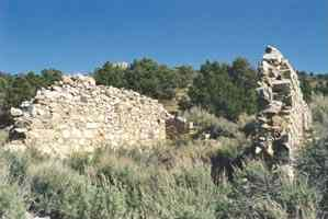
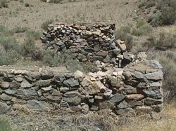
Today, Pine Grove is only a shadow of its former glory, but still claims enough to make it interesting. At the east end of the town, visitors will find an informative historic marker adjacent to the stone remains of a former building.

If you wander through the high sagebrush around the town's remains, it's also still possible to find the remnants of other buildings, such as partial walls and stone foundations. The stone remains of a former building near the historical marker.

A historical marker at the entrance to the site. Gold was discovered in 1866 and the town prospered until about 1880. Peak population was about 600 people in the early 1870s. At one time the town had five saloons, three hotels, and a dance hall.

One hole was particularly interesting because of an intricate stone wall that had been constructed near the entrance (perhaps once part of a building at the opening of the mine).  Of course, as with any abandoned shaft, it's safe to look at from a distance, but never enter the mine. Additionally, the shafts and stamp mill are located on marked, private property.
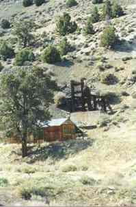
A little farther up the canyon you can find the remains of a leaching operation from the 1960s. Fortunately, the more modern mining work did not destroy a fine wooden and rusted iron stamp mill, still standing on a hill, or the horizontal mining shafts that reach deep into the mountainside. A view of the remains of a 5-stamp mill.

The remains of a five-stamp mill.


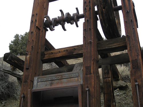
Close up of the remains of a five-stamp mill. The casting reads "Joshua Hendy Iron Works." This company was a world leader in mining equipment and shipbuilding technology and was located in San Francisco, then later, in Sunnyvale, California.


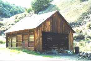
This building appears to have been a garage or storage building.


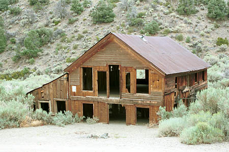
Most of the buildings in Pine Grove were destroyed some years ago when a severe storm sent a mudslide down the canyon destroying almost everything in its path. Today, only a few buildings still remain. Most notably the old boarding house which has about two feet of dirt covering the first floor.

A substantial building; probably a boarding house. The lower floor has become partially buried in runoff soil. This building, half buried, balcony is long gone, dates to the 1870's.  As late as 1969 there were at least 3 other buildings near this one, thanks to vandals, they are no longer standing.
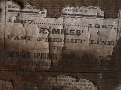
One building, thought to be a cookhouse, The inside is lined with old newspapers on the walls to help keep out the cold winter blasts, some dated back to 1867!  The latest of the newspapers were dated in the early 1930s when the town was vacated to become a true ghost town.


This little house is in great shape, it might be from a latter period.  And this building above looks like an old school house to us but it was probably the mine office.

Sadly, the wooden building you see above has burnt down.

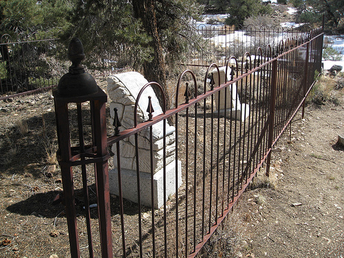
The most interesting thing about Pine Grove is the cemetery.  Remains of the cemetery are high atop the ridge on the north side of the canyon.

ALICE MARIA
Daughter of
A.D. & Sarah A. Robinson
Died Jan. 19, 1868,
Aged 15 years 6 mo's.
& 28 days.
Her last request.
"I want to be an angel.
And with the angels stand.
A crown upon my forehead.
A harp within my hand


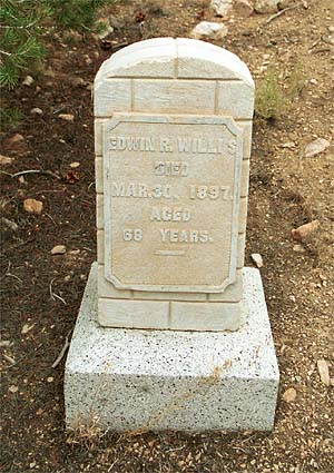
EDWIN R. WILLIS
DIED
MAR. 30, 1897
AGED
68 YEARS


DANIEL JAMES DORSEY.
Born
March 18, 1857.
Weaverville,
Trinity County Cal.
Died Dec 4. 1886.
Pine Grove Nevada.
Aged 29 yrs. 8 months,
& 16 days.


Directly east of the center of the former town, you'll also pass the ruins of a more recent placer operation (they appear to be from the 1960's mining efforts). Here, the rusting remains of various mechanical processing machines have become the newest ghostly remains at Pine Grove.
Several companies have pursued the district in recent times including Teck Resources in the early 1990's. Teck spent US $2.2 million dollars conducting geologic mapping and sampling and also drilled 188 reverse-circulation holes (67,488 ft) and two core holes (614 ft). Much of the drilling was on 100 ft centers. Although much of the district remains unexplored, Teck dropped the property. Lincoln is in possession of all of Teck's technical data, including drill hole logs and certificates of assay from ALS Chemex.
Lincoln controls 100% mineral interest in claims covering nearly 7.2 square miles (18.1 square kilometers). The Company has mining leases on the Wilson and Wheeler mines (12 patented claims) and 243 unpatented claims owned directly by Lincoln. The Company's land position covers the main gold mineralization in the district, exploration targets, and adequate land for mine and processing facilities. The patented claims (private property) are under the jurisdiction of the State of Nevada. Unpatented claims are under the jurisdiction of the U.S. Forest Service.

Pine Grove, NV Ghost Town Video https://youtu.be/GNK0j3cFN_M


Pine Grove Ghost Town Ride from Dayton, NV

This will give you an idea of the condition of the road to Pine Grove.
Related Posts Plugin for WordPress, Blogger...